

Exciting paddle on the Susquehanna River | Conowingo Dam Downriver to Port Deposit

The content of this blog post is generated for entertainment and informative purposes, and is not professional advice. Any outdoor recreational activity carries the inherent risk of injury or death. Any action based on the information supplied in this post is at your own risk.
Conowingo Park to Rock Run, Port Deposit, Cecil County (East Side of the River)
8/2/21 | 1PM
Conowingo Gauge 41800cfs | 13.5ft
Drop In | Conowingo Park | 19 Ratledge Ln, Conowingo, MD 21918


Today Molly, Brittany, and I decided it would be fun to run the Susquehanna from the Conowingo Dam to Port Deposit. We dropped a car off at Rock Run Park, just North of Port Deposit and then drove the kayaks up to Conowingo Park via MD222 North. The park has a few athletic fields and two entrances, we used the North Entrance (second one while traveling north) to get to the launch. When parked in the circular turn around area there is a small wooden bridge, cross this and the launch is about 200 yards down the graveled path. The launch is directly where the Octoraro enters the Susquehanna.
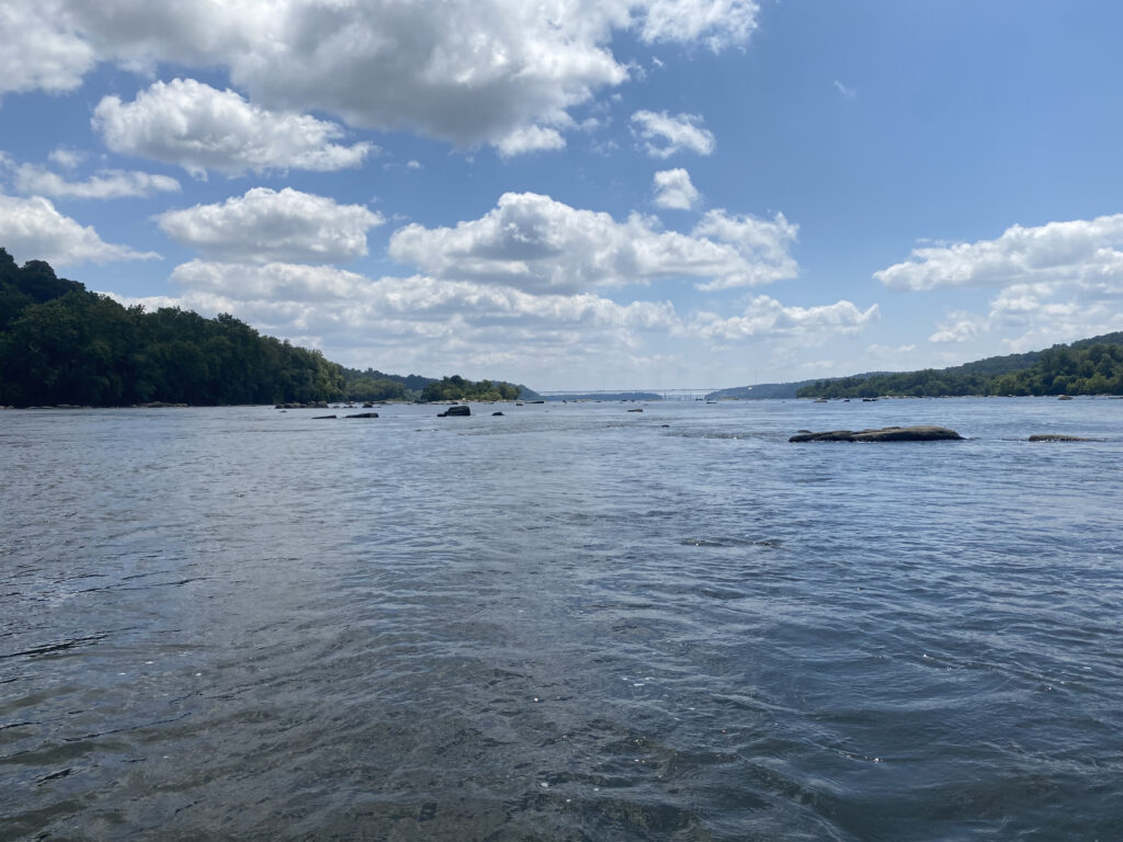
The Susquehanna at this point is expansive – it’s almost a mile wide! The water level is controlled by the operation of the dam and the amount of water is being run though to power the generators. More power needed = more generators online = more water and higher water level. You can check the generation schedule by calling the Conowingo Generation Hotline at 888-457-4076. At the time we departed, the river was running about 41,800 cfs as indicated on the USGS Gauge located below the dam.
The initial part of our trip has smooth flowing water that was quite shallow. It was a bit of a puzzle to find our way though to get to deeper water and larger channels. Any lower and we may have needed to walk the kayaks a bit. There were multiple areas with rocks above the waterline. I would image at a higher water level the majority of these areas would be underwater. As we continued the river became deeper and more swift. It is amazing the volume of water the is moving beneath you. The area surrounding the Conowingo Dam attracts an incredible number of eagles that are in search of fish including shad and herring.
As you make your way downstream we stayed off to the left (east) side of the river no more than 150 yards from the shoreline. The river is so wide that being a short proximity to a shoreline gives comfort. Occasional rocks and other obstructions were easily avoidable, however you did have to pay attention as some rocks were located right beneath the surface. These were observed by ripples in the water.
It took us approximately an hour and a half to travel about six and a half miles to our exit point. The exit is on the left of the river, same side we started on, just before the river becomes predominately tidal and you lose a lot of speed to the decrease in flow. You can see MD222 on the shoreline and Rock Run Park protrudes into the river just after the southern point of Steel Island. On the south side of the park the ramp is located in a small inlet protected by a small unnamed island.
Interested in paddling this journey? We offer offsite rentals!